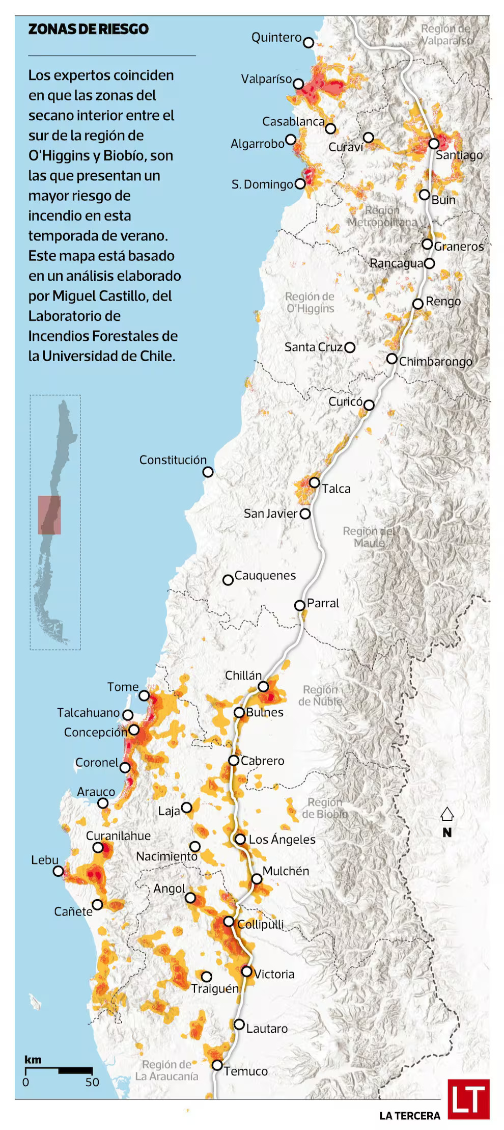
Today, referring to the recent spate of disastrous fires still affecting the BioBio region, Fernando Villegas proposed setting up a network of Drones to monitor high-risk areas.
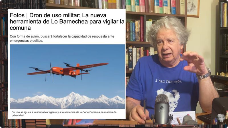
Without doing the sums, I suspect that the expense, logistics and technical capabilities needed to implement such a system to cover large sectors of southern Chile 30/24/7 would be prohibitive, especially for a country that still relies on commercial cellphone coverage to provide emergency communications.
There is an alternative - satellite-based systems. The Copernicus Project already provides Global coverage, although it seems not to be addressed specifically to real-time forest fire detection.
An alternative, the FireSat Mission, being run in association with Google Research, looks more promising, and would use a new dedicated satellite LEO constellation with the aim of quickly detecting the onset of fires.

However, I suspect the “hay que” will remain just that - mere talk.
As usual here, once the media clamour dies down, nothing will change. Already the affected inhabitants of BioBio region are rebuilding their houses - in the same places, using the same material, ie Wood, that allowed the fires to burn whole barrios down so easily.